BOU AVENUE
Sugarloaf Hill And Ironmask Hill

On 10 November 2025, Zosia Zgolak and I tagged a couple of officially-named hills--Sugarloaf Hill and Ironmask Hill--located in the lightly-inhabited southwest corner of Kamloops, British Columbia.  While neither hill presents any technical difficulties, Sugarloaf Hill is slightly more challenging to ascend in terms of route-finding.  Because the approach goes through private or lease land, the Kamloops Hiking Club advises that Sugarloaf Hill should only be climbed between late fall and early spring.  I was uncertain if mid-November would constitute as "late fall", but at the very least, we were five days past the halfway mark between the fall equinox and the winter solstice!

From Trans-Canada Highway, take exit 366 and turn southward on Copperhead Drive.  At the first traffic light, turn right onto Lac Le Jeune Road.  Drive 2.1 kilometres and turn right onto Sugarloaf Road.  Drive 2.7 kilometres to where the pavement ends and becomes 2WD gravel.  Drive another 700 metres and park next to a double-track heading southward.

Zosia and I started walking southward along the double-track just as a woman and her two dogs were returning to the trailhead.  We soon passed a "Private Property--No Trespassing" sign but paid no heed just like the woman we met.  We followed the double-track past a dried-up pond and up an embankment adjacent to Highway 5 before turning toward the northwest aspect of Sugarloaf Hill.  About two kilometres from the start, we veered left at a split and continued uphill along an old exploration road.  Halfway up the hill, this road makes a bit of a long-winded turn, but we opted for an easy off-trail short cut to avoid some unnecessary elevation loss.  We regained the road briefly only to abandon it again to follow a flagged beaten path up the steepest part of the hill.  The actual high point of the hill is covered by trees, but we wandered a little further southeast and found a nice scenic clearing to take a break.  Although we did not go far enough to get a good look, the entire south side of Sugarloaf Hill is characterized by steep cliffs which appear most impressive when driving northbound along Highway 5.

For our descent, Zosia and I mostly retraced our steps except that we took a short cut lower down to regain the double-track just east of the dried-up pond.  We returned to the trailhead without any issues.
"No Trespassing"? No problem! 
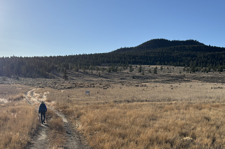
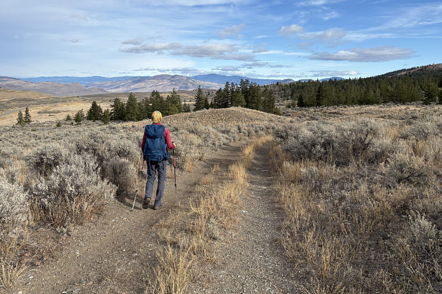
Zosia starts up the double-track which leads to Sugarloaf Hill (right).
Where are the "sailing stones"? 
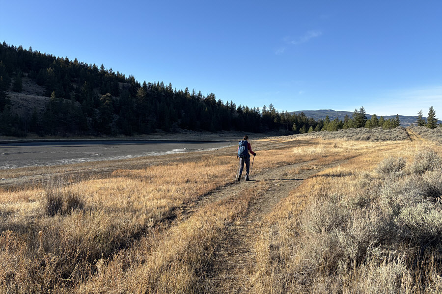
Zosia passes a dried-up pond which seems to be commonplace in this region.
And I, I took the one less traveled by... 
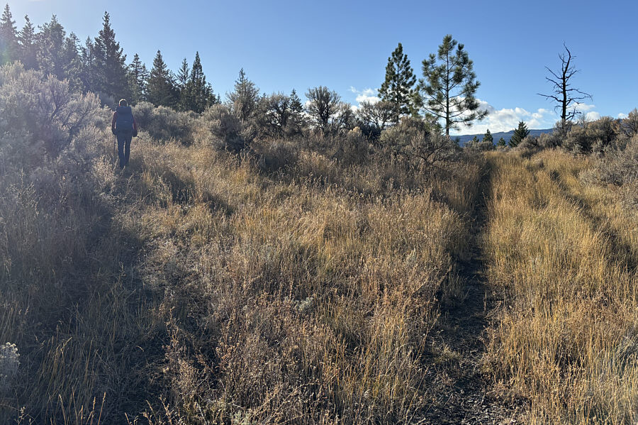
Zosia takes the left-hand fork at this split.
Thank you to the person who flagged the route! 
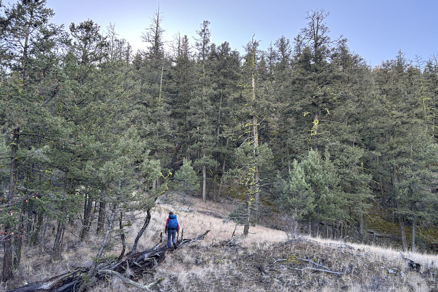
At this point, Zosia is following a flagged route which is partly off-trail.
Still have to hop over a few awkward logs!

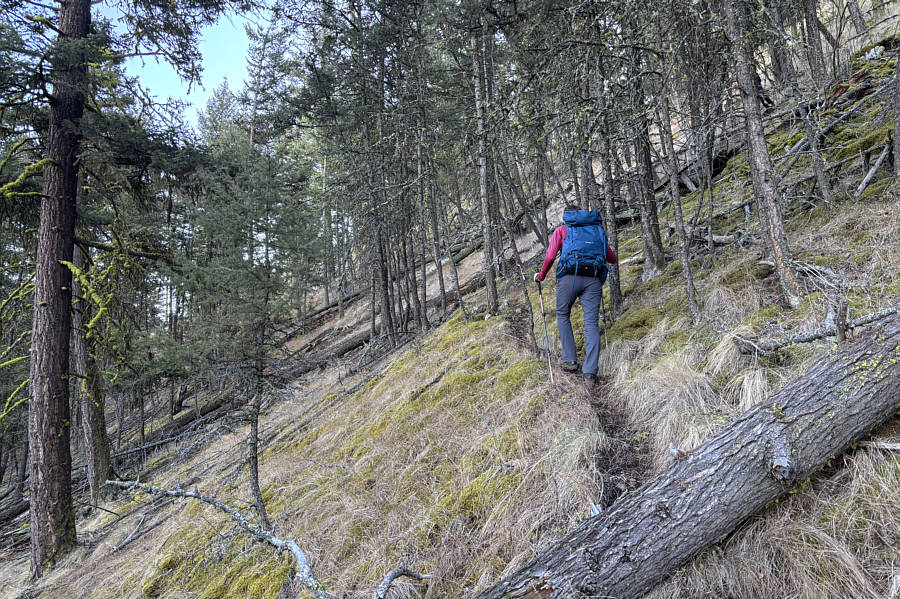
A beaten path makes it easier to ascend the steepest part of the route.

Zero views here, so don't stop... 
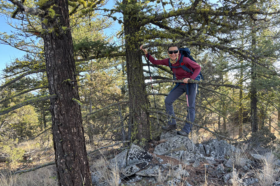
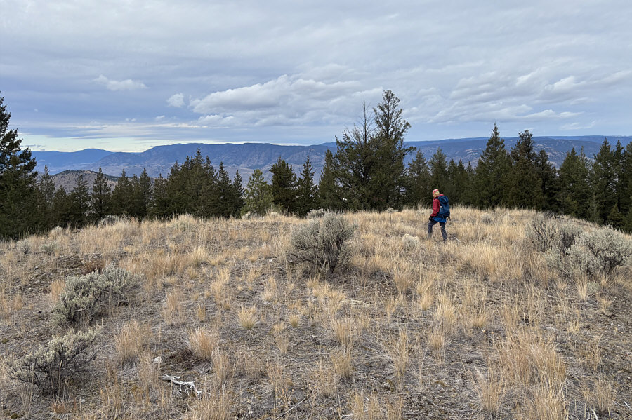
Zosia tries her best to stand on the high point of Sugarloaf Hill (1133 metres).
Makes the ascent more worthwhile! 
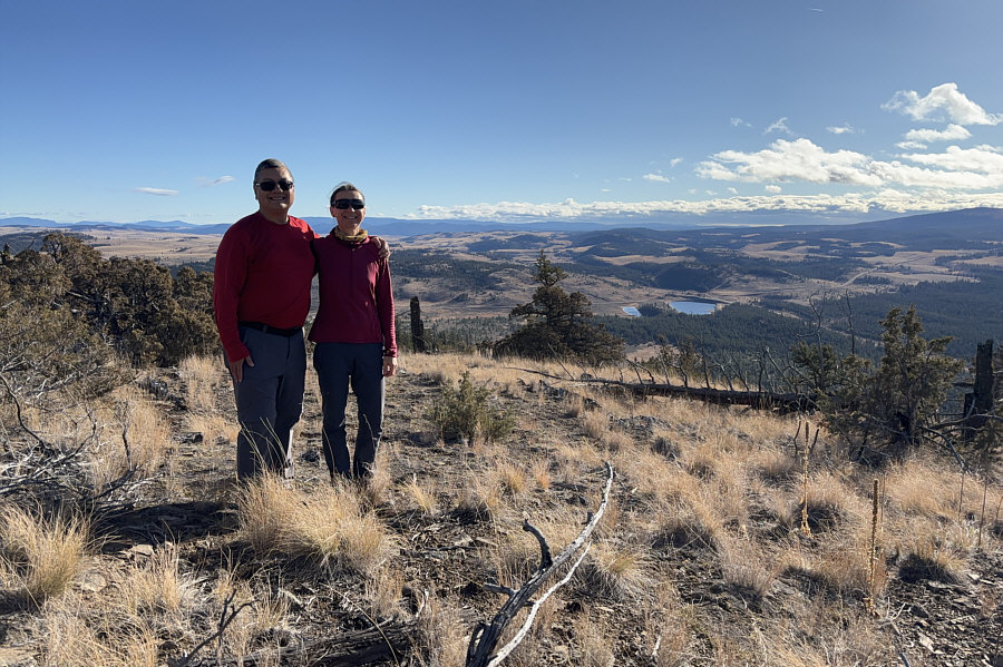
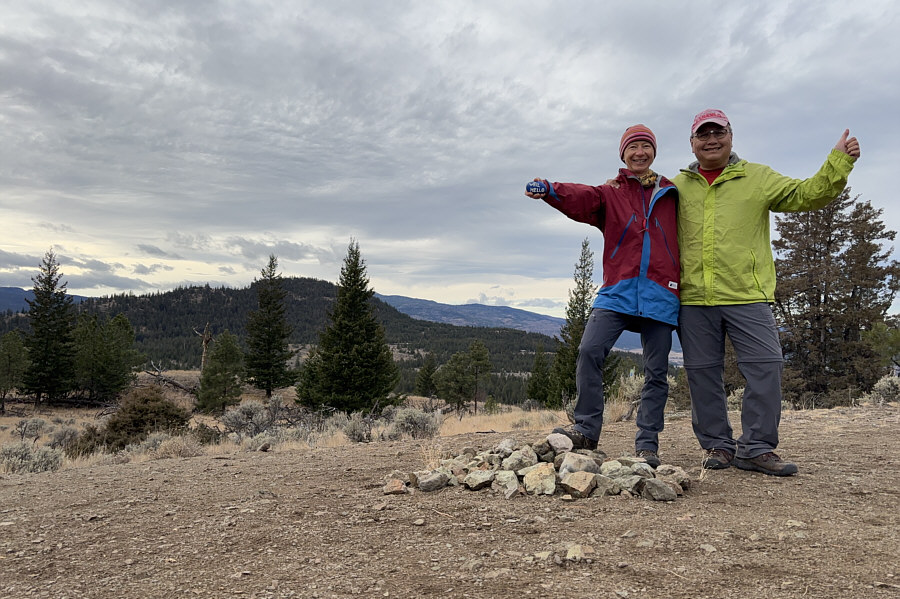
Sonny and Zosia stand in a scenic clearing about 80 metres southeast of the high point.
I didn't know that there is a ski resort on Mount Harper! 
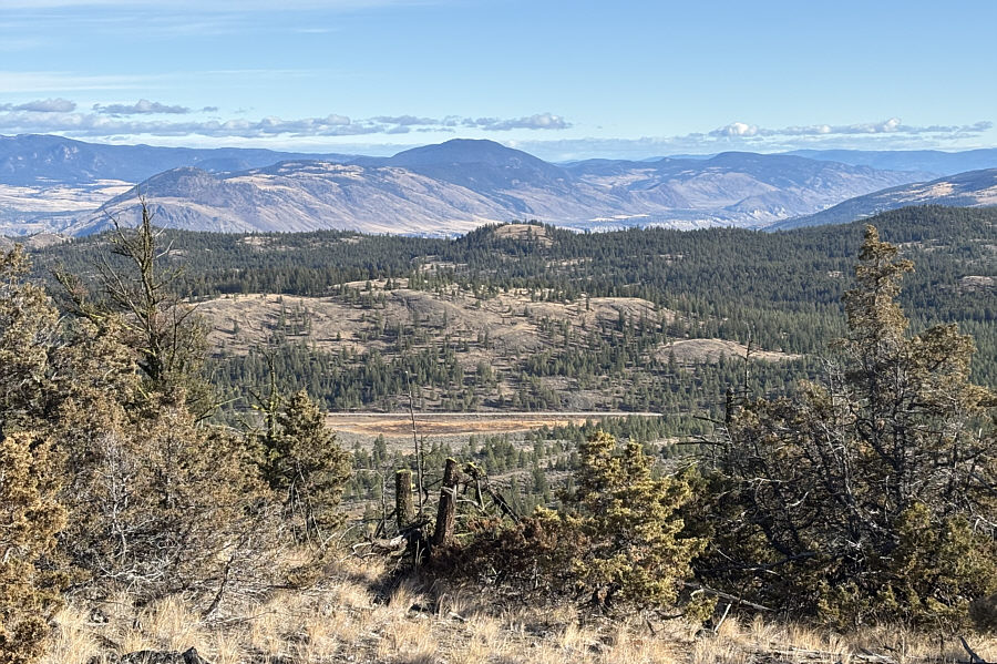
Partially forested Ironmask Hill (centre) is visible to the east.  Behind it on the distant horizon is Mount Harper.
More scenic here than on the high point of the hill! Zosia regains the original double-track on the return trip.
There may be better ascent routes than this one... 
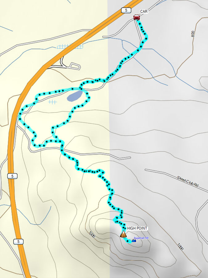
Total Distance:  7.6 kilometres
Round-Trip Time:  3 hours
Cumulative Elevation Gain:  351 metres

GPX Data

With lots of daylight left, Zosia and I drove to the trailhead for Ironmask Hill which is less than two kilometres northeast of Sugarloaf Hill.  Similar to Sugarloaf Hill, there are seasonal restrictions for accessing Ironmask Hill although the timings are nearly reversed.  According to the Kamloops Mountain Bike Trail Association, the trails around Ironmask Hill are only open annually between June 2 and November 30.  Unlike Sugarloaf Hill though, the ascent of Ironmask Hill is nothing more than an easy walk up signed trails.

Use the same driving approach for Sugarloaf Hill, but at the intersection with Sugarloaf Road, keep straight on Lac Le Jeune Road.  Drive 2.4 kilometres and turn left into Pineview Trails West parking lot.  The signed trailhead is at the east side of the parking lot.

To reach the high point of Ironmask Hill, Zosia and I walked up the mountain bike trails named "Coyote", "Road Runner", "Meep Meep", and "Iron Mask".  Other than having to step aside for the odd mountain biker, we had no problems navigating the trails all the way to the top.  For our return, we started on the trail named "More Speed" but then elected to go off-trail and make a beeline for the trailhead.  Avoiding some deadfall near the bottom was the only challenge we encountered.
Let's take the most long-winded trail possible to the top of the hill! 
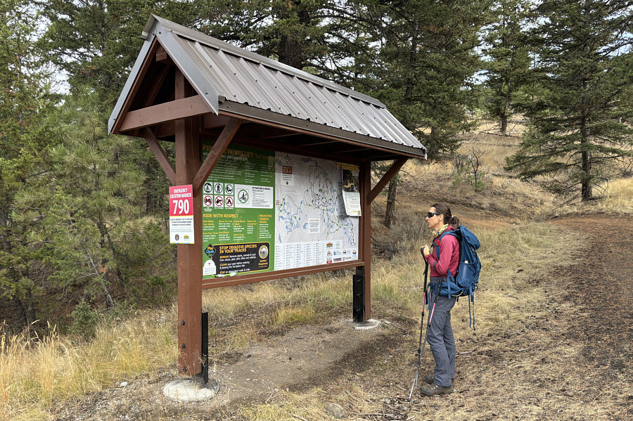
Zosia checks the map at the trailhead for Ironmask Hill.
Tempting to go off-trail and take a more direct line up the hill... 
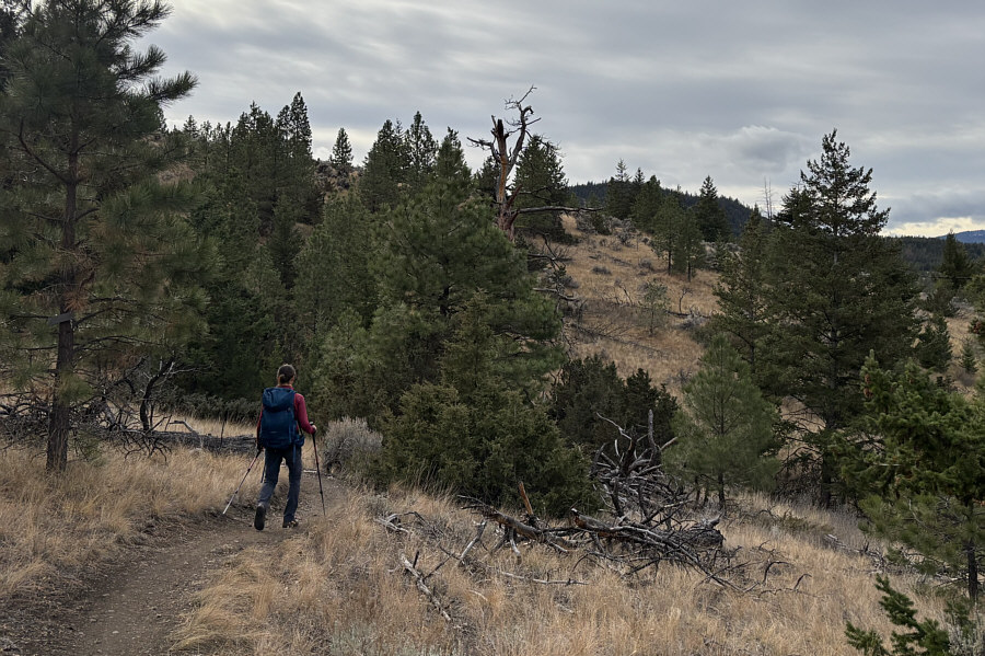
Though technically easy to hike, the mountain biking trails here can feel a bit long-winded for those on foot.
Well, hello! Zosia and Sonny stand on the high point of Ironmask Hill (994 metres).  Visible in the background at left is Sugarloaf Hill.
It took us about 18 minutes to directly descend the hill. On descent, Zosia goes off-trail and takes a more direct line back to the trailhead.
Would be more fun with a mountain bike! 
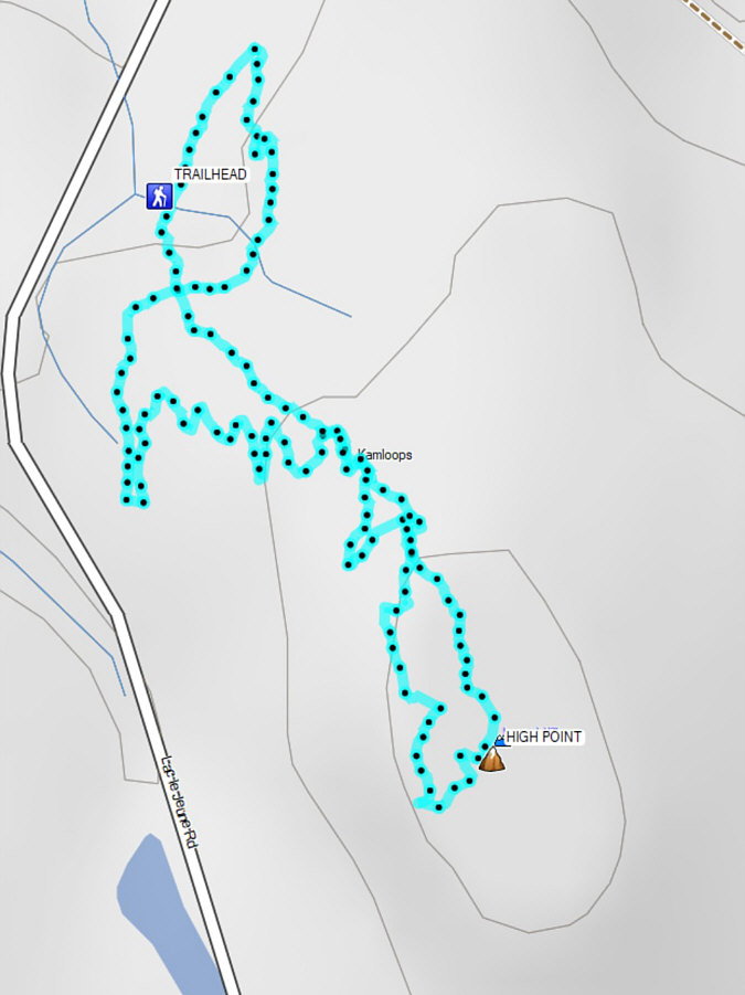
Total Distance:  3.6 kilometres
Round-Trip Time:  1 hour 9 minutes
Cumulative Elevation Gain:  118 metres

GPX Data