BOU AVENUE
Buse Hill

Wrapping up our extended weekend in Kamloops, British Columbia on 11 November 2025, Zosia Zgolak and I hiked Buse Hill located in Buse Lake Protected Area.  We got the idea for this trip from Bob Spirko, but the hike is a popular one for locals probably because of easy access and rewarding views.  Buse Hill is actually comprised of three distinct bumps with the easternmost one being both the gazetted and true high point.  The middle bump is the easiest to access and perhaps the most scenic while the westernmost bump is distinguished by a striking pinnacle.  Our plan was to tag all three bumps going from west to east, but as it turned out, route-finding was not as easy as expected.

If coming from Kamloops, drive east along Trans-Canada Highway and take Exit 384 to Dallas Drive.  Take the second right at a traffic circle and continue eastward along Dallas Drive for 500 metres before veering right onto Barnhartvale Road.  Drive 7.8 kilometres and turn right onto Robbins Range Road.  Drive 450 metres to the end of pavement just past a Texas gate and continue on 2WD gravel for another 1.3 kilometres to a split.  Keep right and drive 850 metres before turning left to continue following Robbins Range Road.  Drive 5.3 kilometres and turn left into a pullout next to a 4x4 road heading uphill to the north.  Park here (50.59976, -120.03665) or continue up the 4x4 road as far as comfort allows (a vehicle with 4x4 capability and high clearance could probably be driven all the way to the top of Buse Hill's middle bump).  Robbins Range Road rejoins Barnhartvale Road 12.8 kilometres further east and 550 metres short of the latter road's junction with Highway 97.  This was our exit driving route, but in reverse, it would be the shortest way to reach the trailhead if approaching from Vernon.

Zosia and I hiked up the 4x4 road for about 875 metres before turning left onto a double-track that I thought would lead us up the west bump.  Instead, we ended up on top of the middle bump after climbing a much steeper route than the conventional one along the 4x4 road.  The scenic plateau and bench atop the middle bump made it tempting to linger, but we did not stay long before dropping down a very steep trail on its west side.  This trail was fairly easy to follow across a dip to the west bump.  A few openings in the forest along the way allow views of the striking pinnacle that sticks out from the west bump's north-facing cliffs.
It was tempting to keep driving up the road... 
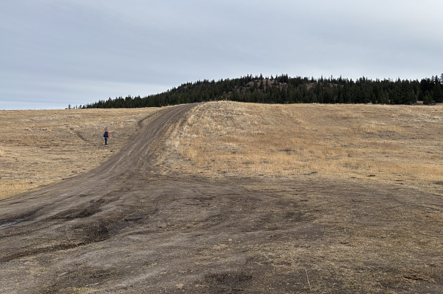
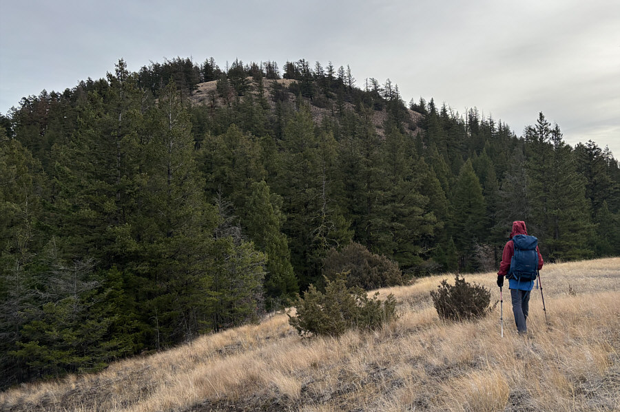
Zosia begins hiking up a 4x4 road which leads to Buse Hill.
You could play soccer here! 
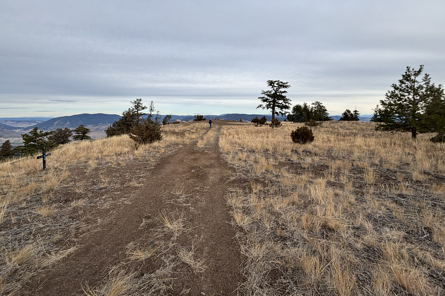
The top of Buse Hill's middle bump is a large flat plateau.
Oops! We meant to climb the west bump first! 
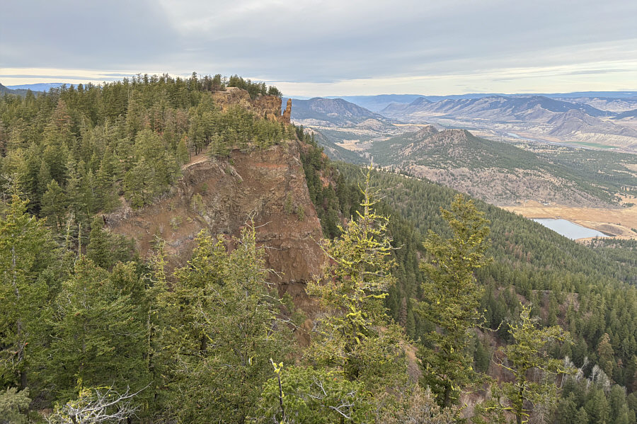
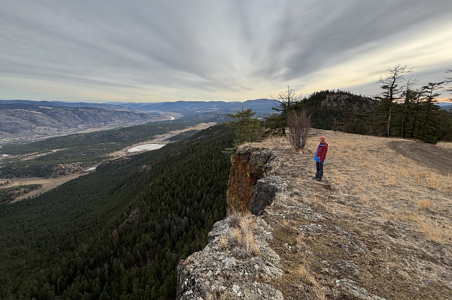
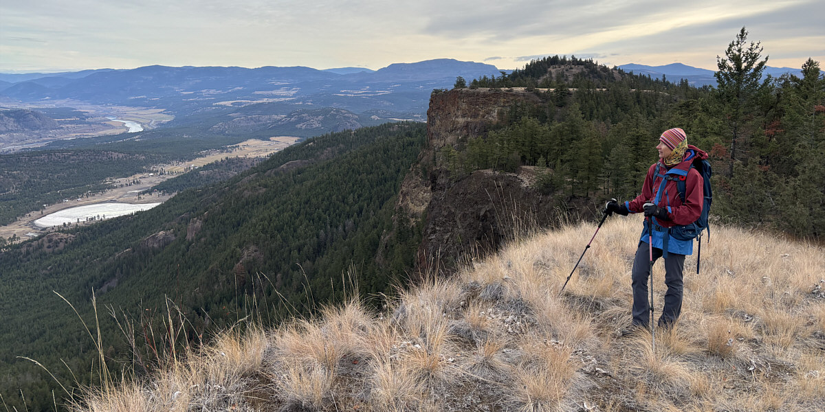
In this view from the middle bump, the west bump of Buse Hill is distinguished by a striking pinnacle.  Visible down in the valley at far right is Upper Buse Lake.
The striking pinnacle is just like our thumbs-up! 
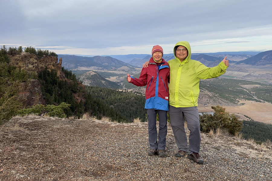
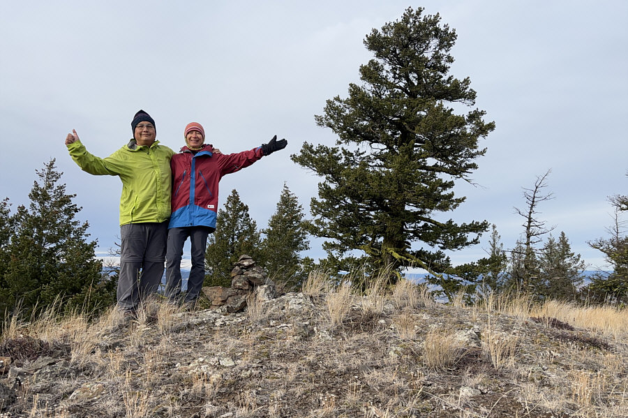
Zosia and Sonny stand near the high point of Buse Hill's middle bump (1101 metres).
Nice reflection! That small ridge also looks inviting but is probably on private property. 
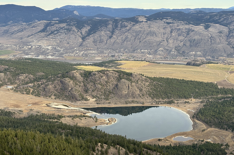
Buse Lake sits just to the north of its namesake hill.
Scary cliffs! This is looking eastward from the middle bump.  Behind Zosia is the east bump of Buse Hill.
The pinnacle looks more striking here! 
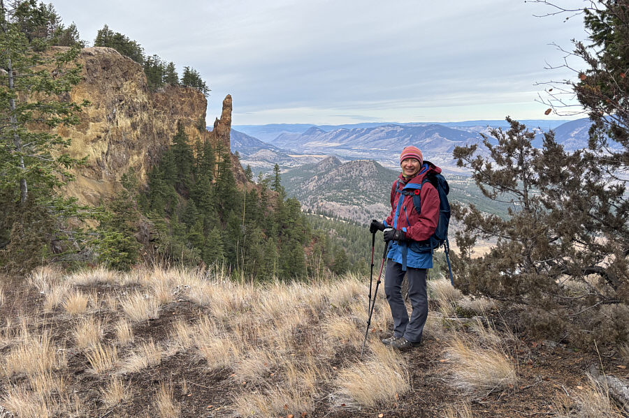
Zosia pauses along the traverse between the middle and west bumps.
Unclimbed or is that a cairn? 
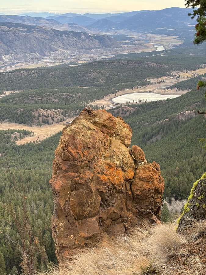
Here is a close-up view of the top of the pinnacle.
 

Those cliffs on the middle bump are definitely scary!

Zosia stands near the top of Buse Hill's west bump (1083 metres) with both the middle and east bumps visible behind her.


After tagging the high point of the west bump, Zosia and I started eastward along a jeep track but eventually abandoned it to avoid losing extra elevation as we contoured around the south side of the middle bump.  Fortunately, the bushwhacking was not bad, and we eventually crossed both our initial route going up the middle bump as well as the 4x4 road.  Getting across the dip between the middle and east bumps was more arduous than expected though.  There is a lot more bush here with seemingly few signs of human passage which is surprising given that the east bump is the true high point.  The final grind up to the top of the east bump was just as steep as our route up the middle bump except without the benefit of a trail.  Once we tagged the cairn and survey marker on top of the east bump, we retreated a short distance down the semi-open west slope before taking a break.

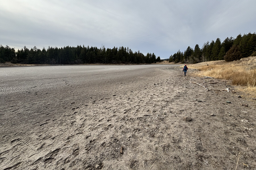
When Zosia and I resumed hiking, we dropped steeply down to a dried-up pond and skirted around its north shore before picking up the original 4x4 road.  The remaining hike back to our car was uneventful except when the clock struck 11:00 AM.  At precisely that time, we both stopped and observed a minute of silence in remembrance of those who fought for our country and our freedoms.  We will remember them.
It's a bit of a thrash to get there... Zosia approaches the east bump of Buse Hill.
Strange that there are no established trails or beaten paths coming up here given that it's the highest of the three bumps. Sonny and Zosia stand on top of Buse Hill's east bump (1132 metres) which is both the gazetted and highest point.
You can still spot the pinnacle if you have a sharp eye! 
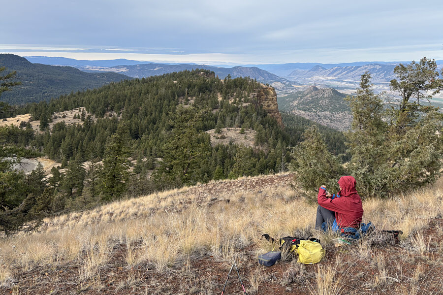
Just below the east bump's high point, Zosia takes a break and enjoys the view of Buse Hill's middle and west bumps.
A very steep descent--poles help a lot here! Zosia descends the east bump aiming for the dried-up pond below.
A bit smelly here... 
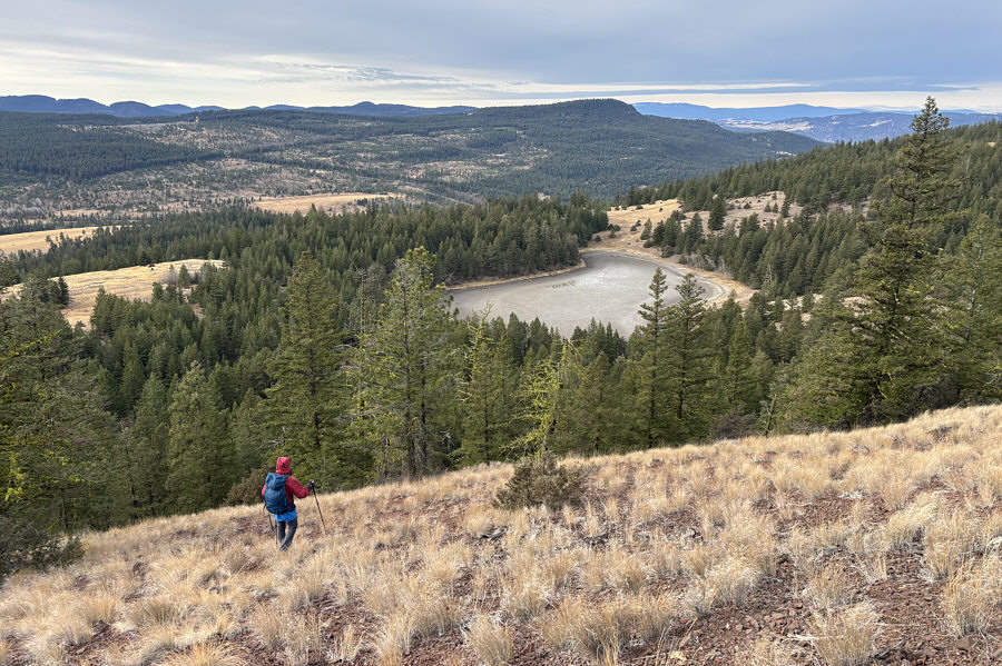
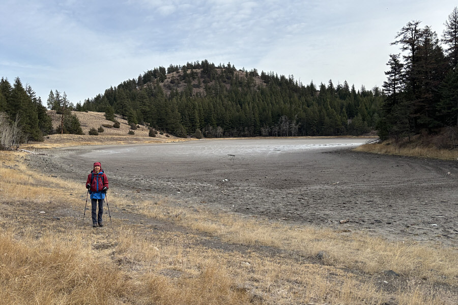
Zosia circles the edge of the dried-up pond.
The hill looks deceivingly innocuous from here. Here is a last look back at Buse Hill's east bump.
We will remember them. 
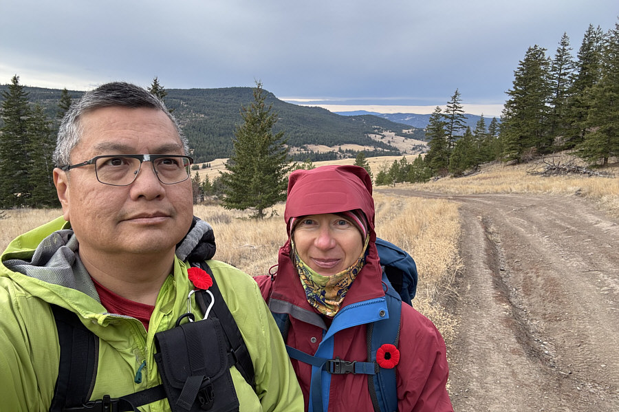
On their way back to the trailhead, Sonny and Zosia both stop and observe a minute of silence at the 11th hour of the 11th day of the 11th month.
Understandably one of the most popular hikes near Kamloops. 
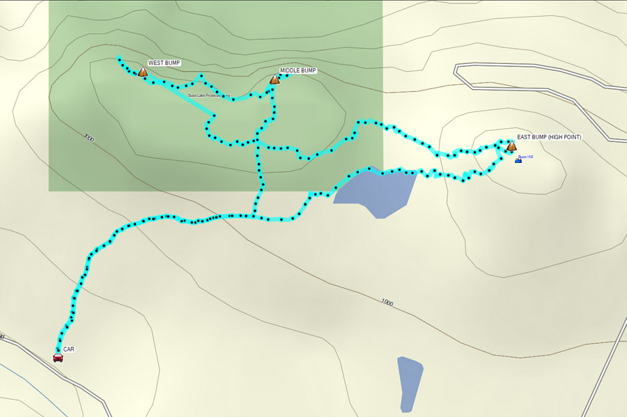
Total Distance:  6.0 kilometres
Round-Trip Time:  2 hours 53 minutes
Cumulative Elevation Gain:  290 metres

GPX Data